
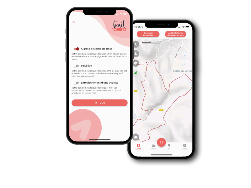
Thanks to Trail Connect, you can locate yourself on your route at any time, follow your route thanks to directional information and start audio guidance during your activity. Activate the route exit alarm to be alerted if you make a mistake.
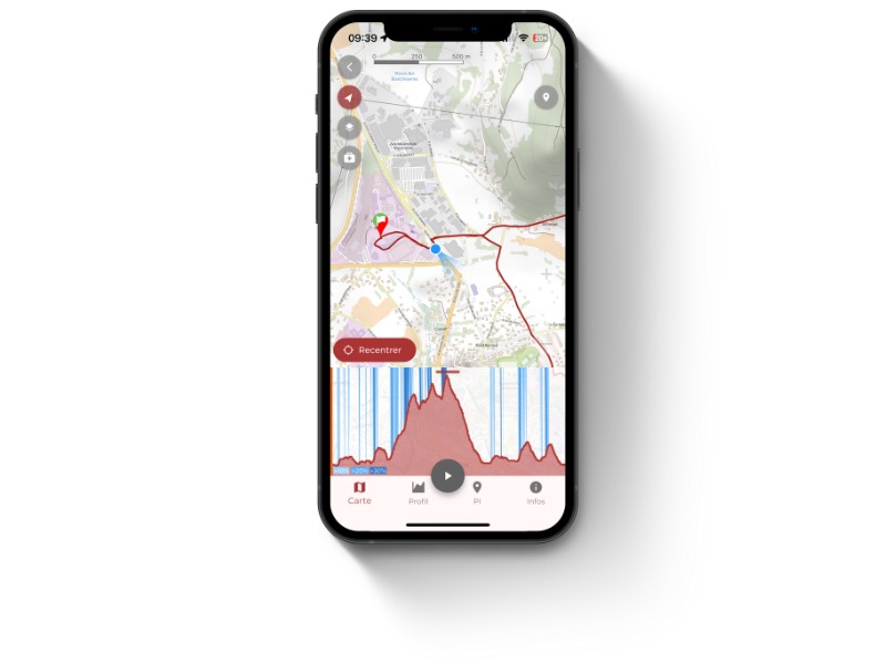
Click on the geolocation button at the top left of the map to view your position on the route.
- On 1st click : your position is displayed on a fixed map. The cone indicates your orientation
- At the 2nd click : the map rotates and the cone is oriented towards North
- 3rd click : your geolocation is deactivated
To make it easier to follow your route, you can activate directional guidance in Trail Connect. You will then be automatically informed of any changes of direction. To do this, you first need to add directional guidance to your route. Here's how :
1. Adding and modifying directional informations :
Directional informations aret automaticaly add when you plot a route in automatic mode, on Trace de Trail website, or in Trail Connect app (click on the links to discover the tutorials on both platforms). They come from the IGN or OSM databases, depending on the data used for the automatic route.
These directional signs can be changed on Trace de Trail website. For this :
- Edit your route
- In Step 1, click on Directional signs to display them
- Click on pencil to edit and modify the directional information

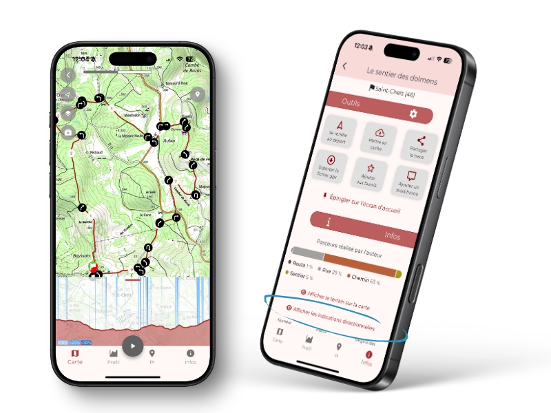
2. View directional information and activate audio guidance
- Open your route in Trail Connect.
- In the Informations section click on Display directions if you want to view them.
- If you want to activate audio guidance, start recod activity and authorise directional announcements in the application settings
You don't know the itinerary ? Activate the functionality to follow an itinerary and let be guided by the sound of your mobile phone. In the. settings, configure the distance between two position checks and maximum distance to the track and activate the function by a simple clic on the icon at the top left on the map. This function is activable / desactivable by a simple clic on the icon.

 Trail Connect